Credits:
https://dawsoncity.ca/top-of-the-world/
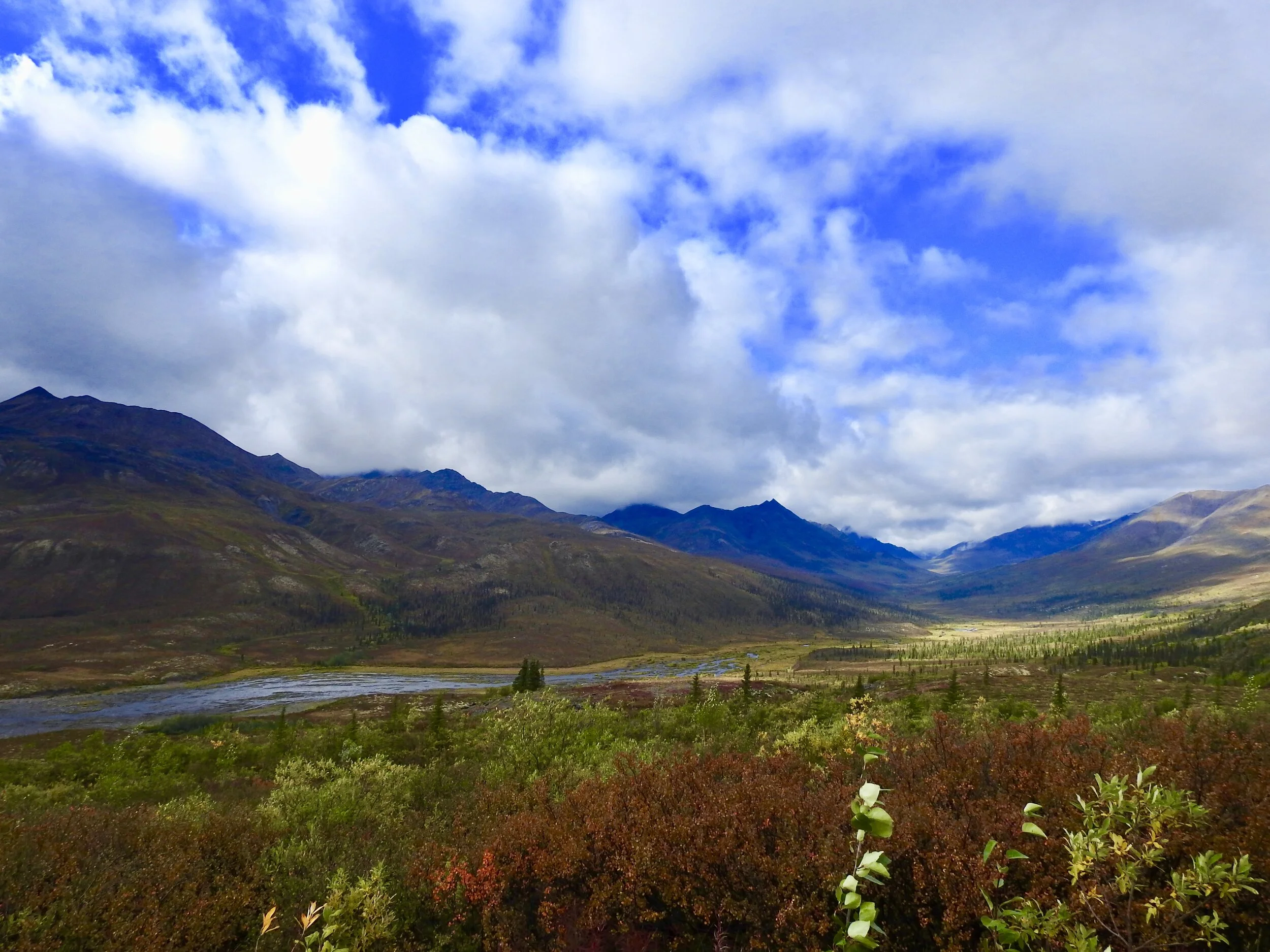
The roadtrip was well under way and we drove for 6 hours to Dawson City.
On the drive, we passed by Pelly Crossing, located midway between Whitehorse and Dawson City on the North Klondike Highway near the banks of the Pelly River. The community of Pelly Crossing is home to the Selkirk First Nation and a small community of about 300 people.
We also passed by Stewart Crossing, which is located on the Stewart River.
Stop #1: Five Finger Rapids - Highly Recommended
Drive north of Carmacks for 23km along the Klondike Highway. There is a rest stop with a viewing platform, and you can walk down the stairs for the trail which is about 1.60km return trip.

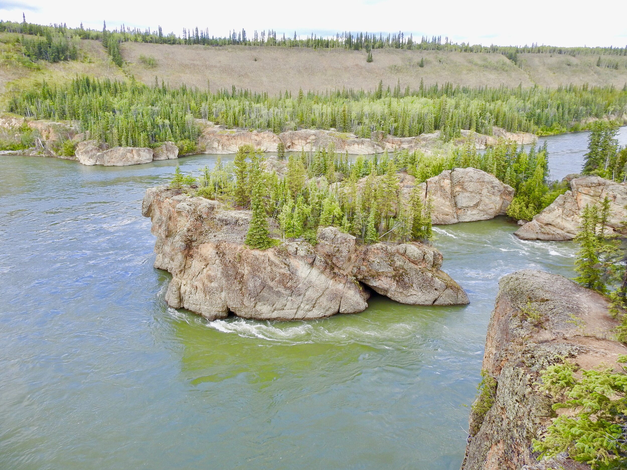
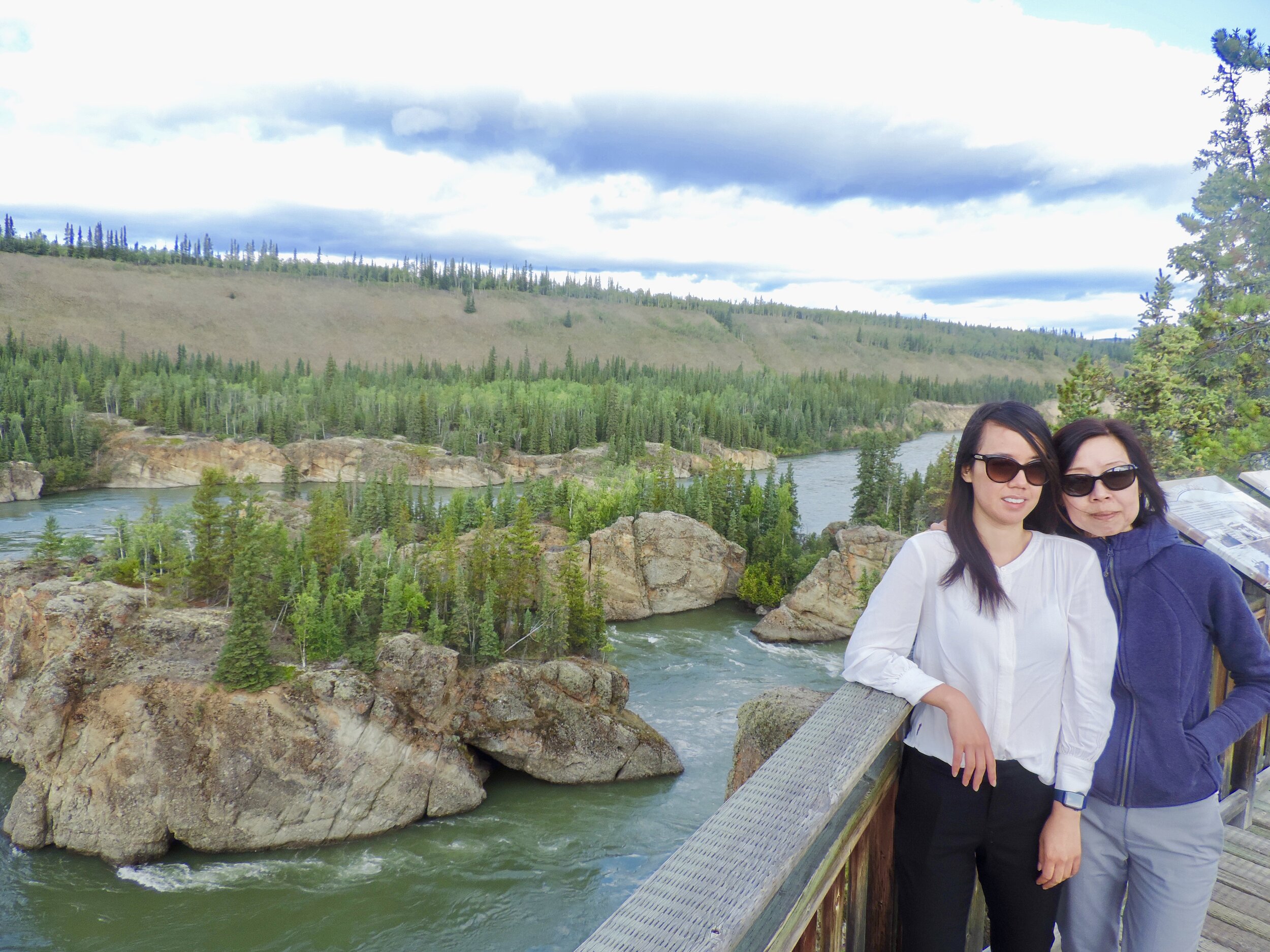
Although there is a manufactured staircase, I’d caution to carry bear spray on the walk to the rapids.
The name comes from the 4 islands that divided the river into 5 channels. The rapids here had to be negotiated during the gold rush days by many pioneers. They were precarious for gold seekers during the Klondike Gold Rush. The site provides a beautiful viewpoint overlooking the Yukon River. This site is distinctive in the sense that these “fingers” are composed of conglomerate rock that is more resistant to erosion than surrounding mudstone layers.
Stop #2: Top of the World Highway - Highly Recommended
The Top of the World Highway was built in 1955 and links Dawson City to Alaska. Open from May to September, this partially paved road takes the adventurous driver high along mountain ridges, making for spectacular views in all directions, and is the ultimate joyride.
You can take the George Black Ferry across the Yukon River; about 5 kilometers up the road.

Some notable viewpoints are:
At KM 56, you’ll find a natural rock outcropping referred to as Castle Rock. This geologic landmark was shaped by erosion.
At KM 59, is the Clinton Creek Road. This road once led to an asbestos mine, active in the 1960’s and 70’s, now abandoned.
The Clinton Creek Road will also give you access to the historic Forty Mile town site. Located at the confluence of the Yukon and Forty Mile rivers, this site has been used by generations of First Nations families to hunt caribou and fish for arctic grayling.


The Top of the World Highway reaches its summit around kilometer 104, with an elevation of 1,376 meters, or 4,515 feet. Be sure to stop here to take in the beautiful, panoramic view.
Just past this viewpoint, you’ll reach the Canada/U.S. border.
The Top of the World Highway is a drive not to be missed, whether you just want to see the highlights or you wish to travel on to Alaska. Make sure to check local travel restrictions before planning your trip. The Canada/U.S. border is currently closed.