Difficulty: Moderate (some technical parts, and slight incline)
Estimated Time: 3.5 hours (definitely less if you’re experienced)
Round Trip: 9km
Elevation Gain: 225m
Season: Year-round
Car Travelling Time from Vancouver: 40 minutes
Public Transit: No
Credits: https://www.vancouvertrails.com/trails/woodland-walk-trail/
You can find parking on the side of the road by the yellow gate.
Located in the mountains hovering over Coquitlam, the Woodland Walk Trail intersects Pinecone Burke Provincial Park to the magnificent Sawblade Falls.

A notable and memorable part of this trail is its proximity to the gunfire shots from the Port Coquitlam and District Hunting and Fishing Club. The gunshots from the shooting range are loud and can be heard until you delve deeper into the forest of the Burke Mountain area. Furthermore, there are a lot of trails and they are not well marked in terms of signage. I would advise to stick to the trail markers, lest you go off trail. During rainy season, there is a lot of mud, so take heed in terms of deciding what shoes to wear.
To find the start of the trail, do not walk up the gravel road, instead walk onto the trail directly to the left of the metal gate and follow this trail as it weaves its way up hill, over wooden steps and planks. You might encounter some mountain bikers along the way.
You will pass by a clearing underneath a set of BC Hydro power lines. Continue on and enter the forest and follow this trail as it very gradually ascends through the second generation growth.

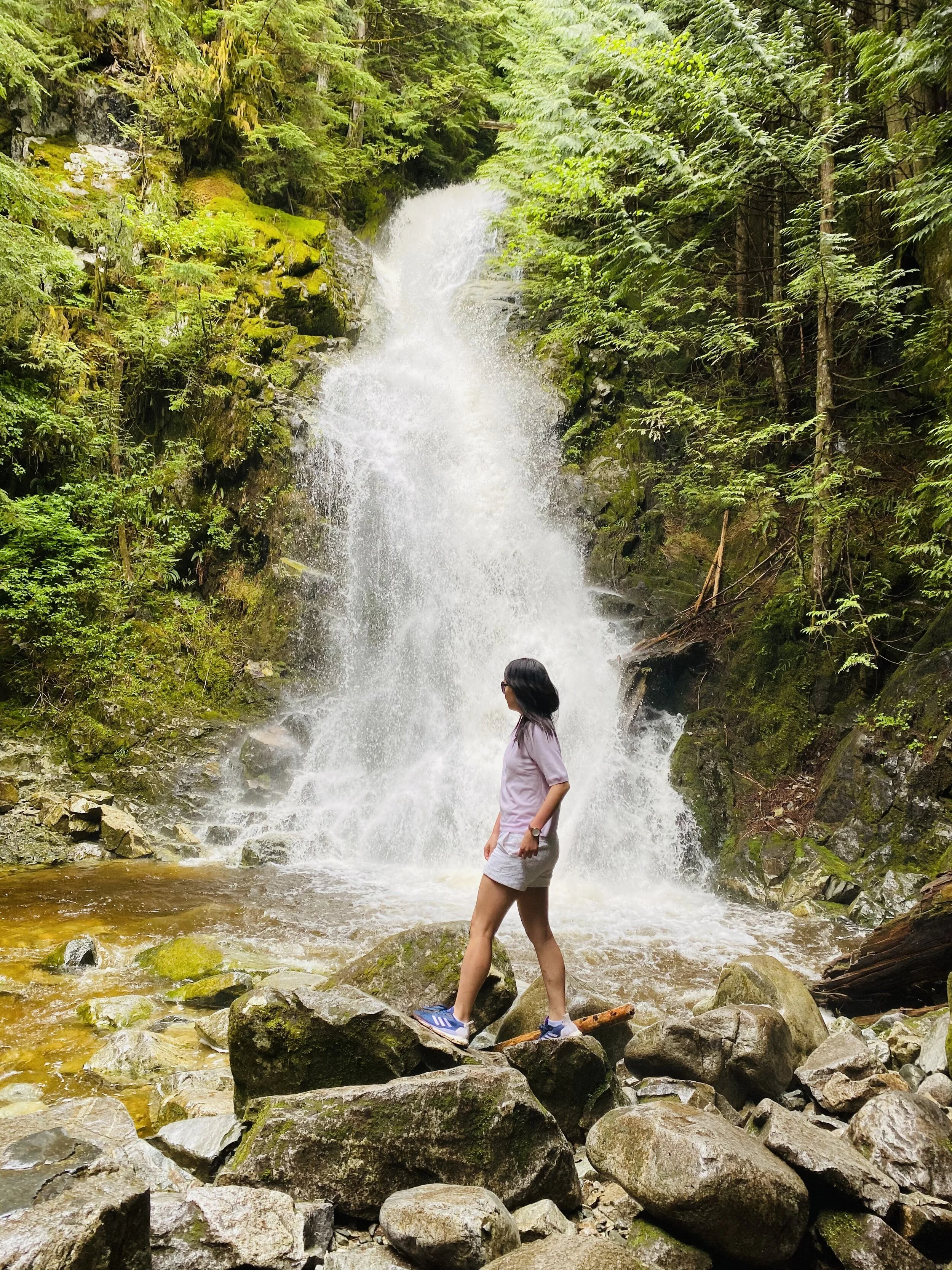
The trail continues to meander through the forest until it reaches a junction. Located further upstream, Sawblade Falls is more magnficent than Woodland Falls.

I would definitely recommend viewing the waterfall from various perspectives, from the top where it is partially shrouded, then descending to the base, where you can feel the full flow of the waterfall. It is simply awe-inspiring and exhilarating to appreciate the full force of nature.


Continue following the Lower Loop and, when you reach a junction, go right as the trail descends gradually. The trail opens up as you arrive back at the power lines. Walk to the left along the gravel road under the power lines, passing the start of the Upper Loop route and walking over the Prichard Creek bridge. Just after the bridge, go right and follow the trail back the same route that you took earlier. When it reaches the gravel road, immediately go right and stay on the forested trail, as it quickly descends bringing you back to Harper Road where you began.