Difficulty: Intermediate
Estimated Time: 5 hours
Round Trip: 11km
Elevation Gain: 225m
Season: 460m
Car Travelling Time from Vancouver: 45 minutes
Public Transit:
Credits: https://www.vancouvertrails.com/trails/st-marks-summit/
St. Mark's Summit is part of the Howe Sound Crest Trail that extends 30km from Cypress to the Sea to Sky Highway. The trailhead starts at Cypress Mountain which is the first mountain along this route and offers spectacular views of Howe Sound on a clear day.
From the Cypress Mountain downhill parking lot, look for the Howe Sound Crest Trail sign. When we were there, there were booths with people who were helpful with instructions. Also, as you go along the trail, there are markers with various instructions. Follow the trail uphill until it merges onto a wider ski run and veer to the left towards a large green water tower. Just before the tower, go right onto a trail and walk uphill through the trees.
After a short hike, the trail reaches a gravel road. You are now on the Howe Sound Crest Trail and this route will take you to St. Mark's Summit. AJust beyond the mapboard is a clearing with a view of the Lions in the distance. Continue along the trail as it winds along the mountainside and slowly heads uphill.
The trail starts climbing gradually, crosses two bridges before continuing uphill. The climb starts to steepen as the trail goes through a series of switchbacks, and you encounter another series of increasingly elevated switchbacks.
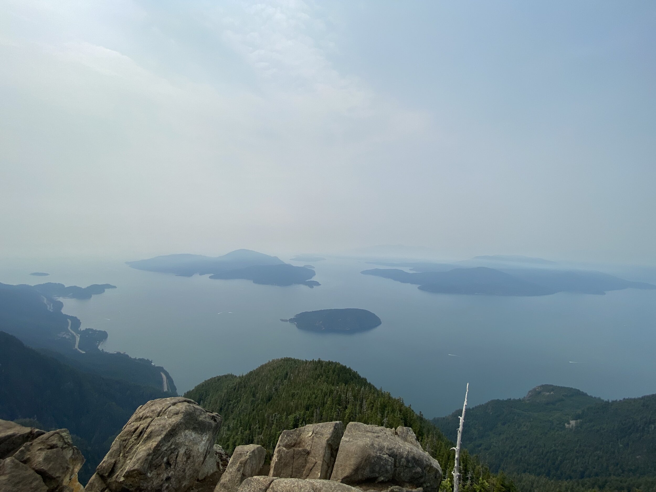
As the trail levels out, you have reached the upper region of St. Mark's Summit. Continue another brief distance over the rocky terrain until you reach a point where you can see Unnecessary Mountain and the Lions off in the distance. Do not descend but instead, go left to a scenic viewpoint of the area. On a clear day, you can enjoy views of Howe Sound, the Tantalus Range, and even the Gulf Islands and Vancouver Island away in the distance. Another tip would be that there are a few other viewpoints along the short ridge, if you navigate to the side. These are worth checking out, as they provide even more tranquil and stunning views and better photo opportunities.


After relaxing and taking in the gorgeous views, you can make your way back to the trail and retrace your steps heading back downhill through the switchbacks towards Mt. Strachan Meadows and the parking lot at Cypress Mountain. Definitely be careful on your way down due to the elevation and switchbacks!
